
Every year, hundreds of confused students enter your school for the first time. Anxiety is high as they try to navigate the school campus in search of classrooms, admin offices, restrooms, and food. A free digital signage system can simplify the experience by providing clear, accessible maps of the campus that go far beyond printed posters or static images. From interactive wayfinding to mobile integration, digital signage has transformed how schools help users find their way.

From Static to Smart: Modern School Wayfinding
While traditional maps still serve a purpose, today's digital signage has advanced to support fully interactive digital building directory displays. These systems allow students to quickly identify their location, view routes to their next destination, and interact with the display using touch or voice controls. For example, digital directories now include searchable features, zoomable campus layouts, and real-time room availability—all of which reduce confusion and improve campus flow.
Some schools use devices like Raspberry Pi or Chrome-powered players to deliver cost-effective touchscreen experiences. These setups run seamlessly with Rise Vision's free digital signage system, allowing schools to deploy maps across entrances, hallways, libraries, and more without relying on complex IT infrastructure.

Learn more about digital directories here.
Simplified Navigation with Interactive Displays
Modern wayfinding systems offer layered navigation for multi-floor buildings—ideal for large campuses with stacked classrooms. These directories can show floor levels, elevator routes, and even accessibility paths for students with mobility challenges. They're perfect for high-traffic areas such as student centers and administrative wings.
Touch-enabled signage supports multi-language options, enabling schools to serve diverse communities more effectively. Features like "You Are Here" indicators, motion-triggered assistance, and real-time announcements add usability for all users.

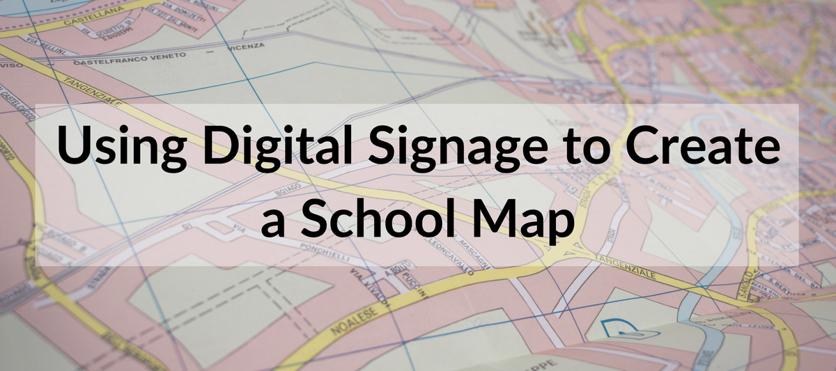
While the wayfinder maps above are great for buildings, most schools also want to use digital signage to display a larger map of their entire campus. There are several ways users do this, but the most common is to upload images of the maps--some even use Google Docs to display their map. The image below shows how the College of Lake County added a larger campus map to their digital signage.
Promoting Library Navigation and Resource Discovery
Beyond navigation, digital signage displays can help students locate library materials or see what's newly available. For instance, integrating a digital building directory inside the library can provide section guides and study room availability, and promote live workshops or author events.
Because the signage can be pulled from online databases, it ensures that the content remains up to date without requiring manual changes. Whether highlighting new arrivals or directing students to specific sections, the screens serve as dynamic information hubs.

Full Campus Maps with Real-Time Integration
Many institutions are now displaying full-campus maps that are interactive and accessible via QR codes. This lets students pull up the map on their phones, making it easier to navigate on the go. A great example of this approach is the College of Lake County. It implemented a map with a "You Are Here" pin and highlighted building overlays to help students understand their current position about their destination.
These interactive maps can also integrate with learning management systems (LMS) and calendar apps to show real-time class schedules, event locations, or emergency alerts. This added layer of functionality turns signage into a central resource for orientation and daily navigation.
Compatible Across All Major Platforms
One of Rise Vision's strengths is its flexibility. It works with Windows, Linux, Raspberry Pi, and Chrome, so schools can select the hardware that fits their budget and infrastructure. Whether you're deploying interactive kiosks at each entrance or passive displays in waiting areas, the platform ensures consistent performance and simple content management.
Best Practices and Inspiration
Digital signage maps are just one use case. Schools are leveraging Rise Vision to deliver announcements, emergency messages, performance dashboards, and more. If you want to take your system further, check out our post on digital signage best practices for schools and our list of school digital signage ideas to help inspire your next deployment.
More From Our Blog
-
Digital Signage Best Practices for Schools and Organizations
Effective digital signage starts with legible design, accessible contrast, and content that matches your viewing environment. Keep screens current with a content plan, make updates simple enough for[…]
Read More -
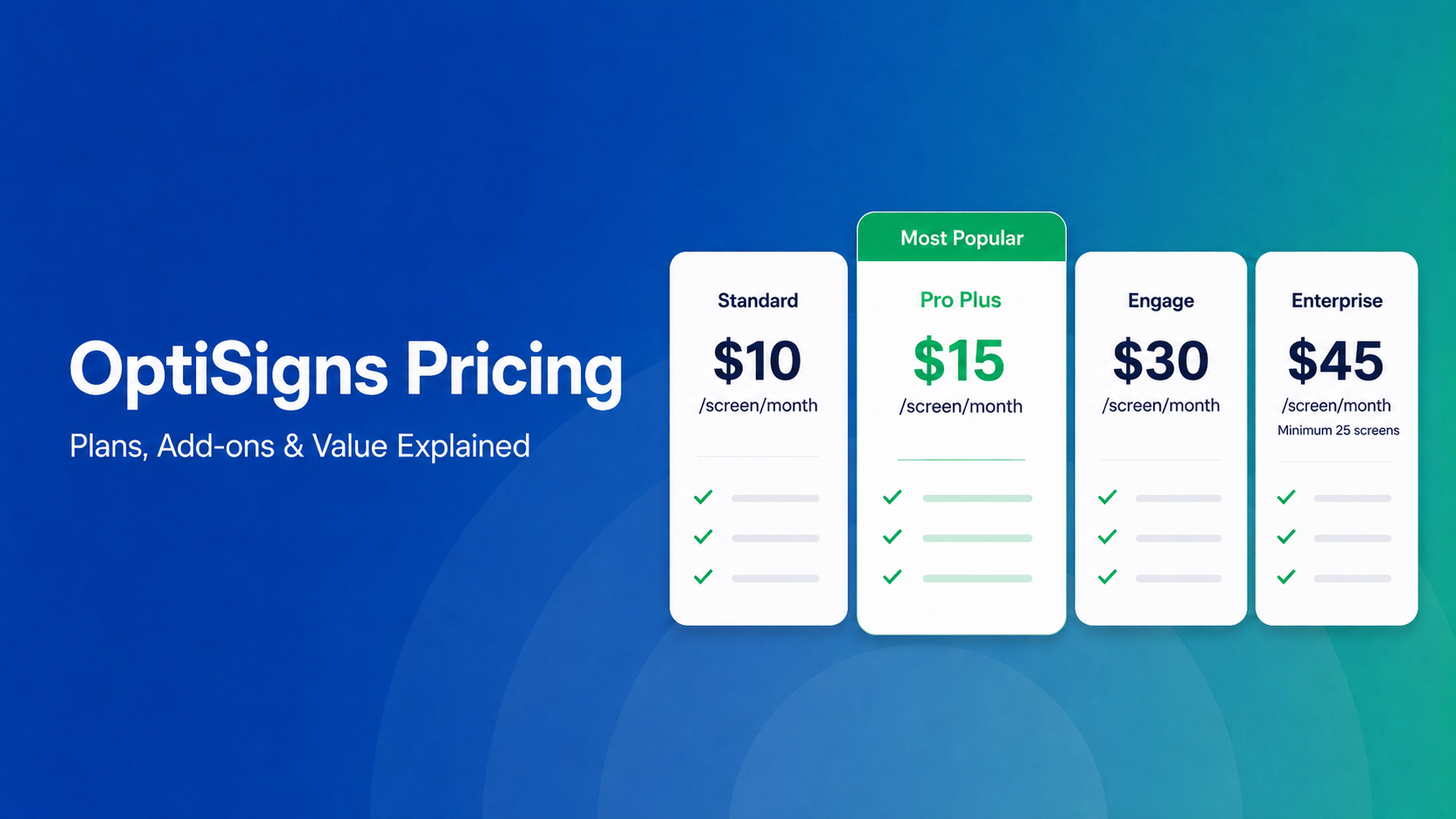
OptiSigns Pricing in 2026: Plans, Add-Ons, and What It Really Costs
OptiSigns' paid plans run $10–$45/screen/month ($9–$40.50 on annual billing). Add-ons for wireless presentation and video walls aren't included in any base plan, and phone support requires an upgrade[…]
Read More -

Yodeck Pricing: Plans, Costs & What Changed in 2026
Yodeck bills per-screen with no ceiling (free up to $16/screen/mo) so costs rise with every display added. 2026 Price Increase: Yodeck raised Premium and Enterprise plans by $1/month per screen,[…]
Read More
12,300+ Organizations Trust Rise Vision, You Can Too


Schedule a Free Demo
You deserve the #1 all-in-one platform for digital signage, screen sharing, and emergency alerts.


